The following notes are summarised from the Victoria History of the County of Lancashire ('VCHL'), in 8 vols, edited by William Farrer and J. Brownbill (1906-1911, reprinted 1992)
-
The Healdhouses, near Moss Side, Manchester
- M14 4HH
-- SJ848955
-- OS 1848
- Healdhouses was originally part of the large manor of Withington, south of Manchester. The VCHL (vol 4, p.292) traces how it "was granted to the Traffords [33] [lords of the manors of Trafford and Stretford] and held by them from the 13th to the 16th centuries [34] when part or all was sold to the Mosleys [35]" .
- "n33. Ellis son of Robert de Pendlebury granted to Henry son of Robert son of Ralph de Trafford all the land of 'Gildehusetide' within boundaries beginning at Gooselache, thence to a pool where Matthew son of William [lord of the manor of Withington] raised a dyke to turn the water for his mill; by another dyke to the moss and so back to Gooselache; with all the liberties which the freemen of the said Matthew his lord enjoyed, but Matthew would have a road across the land for carrying his hay."
- Other deeds discussed use the variant spellings Gildhouses, Yhildhouse (1317), Yeldehouse (1449, 1563), Yeldhouses (1513) and Yeeld Houses (1617).
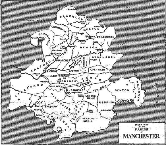
map from the Victoria County History - Eventually several parts of the old manor acquired their own identities, including Didsbury, Burnage, Levenshulme, Rusholme, Moss Side, and Chorlton with Hardy. "The district anciently known as Yeeldhouses, and later as the Healdhouses, lay near the northern border [of the reduced Withington], stretching into Rusholme and Moss Side." (VCHL vol 4, p. 288)
- "The Traffords and others also held lands in Moss Side, but there seems to be no way of distinguishing their estate here from other lands held by them of the lords of Withington; some or all of their land in the Yeeldhouses was no doubt in Moss Side, as traces of the name remain until recently [9]" (VCHL vol 4, p.302)
- n9: "Great and Little Heald, otherwise called 'Trafford Land,' lay on the south-east border of the main portion of Moss Side, as is shown by old estate maps. It is now popularly known as the 'Temperance Settlement' in Marine Road, formerly Dogkennel lane." (VCHL vol 4, p.302)
- "The Heald in the north-west [of Rusholme] is part of a district of the name stretching west into Moss Side" (VCHL vol 4 p.303)
- The 1847 Ordnance Survey map shows Heald House about 200m east of Dog Kennel Lane, on the site of what is now Heald Place and Heald Avenue. The house itself has long since been swept away, along with Marine Road and Dogkennel lane.
- Healdhouses was originally part of the large manor of Withington, south of Manchester. The VCHL (vol 4, p.292) traces how it "was granted to the Traffords [33] [lords of the manors of Trafford and Stretford] and held by them from the 13th to the 16th centuries [34] when part or all was sold to the Mosleys [35]" .
-
Healds Green, Chadderton, Oldham
- OL1 2SP
-- SJ848955
-- OS 1848
- Appears as Yealds Green on Hennet's map (1829). The same roads and settlements are visible (unnamed) on Yates's map (1789).
- Appears as Yealds Green on Hennet's map (1829). The same roads and settlements are visible (unnamed) on Yates's map (1789).
-
Heald Moor, near Bacup
- OL13 8QZ
-- SJ848955
-- OS 1849
- Part of the parish of Cliviger; the source of the river Calder.
- "An earthwork of uncertain age, called the Old Dyke, crosses Heald Moor from north-west to south-east, and was the traditional limit of Rossendale Forest" (VCHL, vol 6, p.479).
- Some of the land was bequeathed to found Newchurch Grammar School in Rossendale in 1701 by John Kershaw, "for instruction in Latin and English subjects free; other subjects were to be paid for," notes the VCHL, vol 2, p.613. "The endowment amounted to about Ł60 per annum. Kershaw's tombstone bears the following inscription:-
- "In memory of John Kershaw of Wolfenden Boote Fold, the beneficient donor of the estates situated in Heald, Bacup, Booth for the benefit of New Church School. He was buried 1 February, 1701, aged eighty-five years. Anne Kershaw, his wife, was buried 4 January 1709. -- They lived long beloved / And dyed bewailed / And two estates / Upon one school entailed."
- Hennet's map of 1829 marks Heald (the summit) and Heald Fold (buildings).
- Part of the parish of Cliviger; the source of the river Calder.
-
The Heald, Newton-le-Willows, near Winwick
- WA12 9NT
-- SJ848955
-- OS 1849
- "[1373] John de Eccleston [lord of the manors of Eccleston and Rainhill, both near St. Helens] also held lands in Newton called Perpount Field and the Held", VCHL vol 3, p.363
- "A rental of the second John, lord of Eccleston, compiled about 1476, is preserved at Scarisbrick. It comprises both Eccleston and the Held..." p.364
- "Among various place-names occurring in the charters [of landowners discussed in Newton] may be recorded Apshaw, Heald, Kirkacre and Pipersfield." vol 4, p.135
- Marked as Yeld on Yates' map (1789), and as Heald Farm on the Ordnance Survey (1851).
- "[1373] John de Eccleston [lord of the manors of Eccleston and Rainhill, both near St. Helens] also held lands in Newton called Perpount Field and the Held", VCHL vol 3, p.363